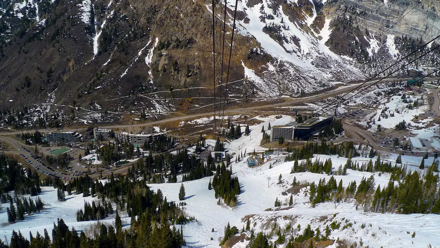

At Snowbird, we found at least 1 place to stay about a 5-minute walk or less from the bottom of a lift. The closest we found is The Lodge at Snowbird, about 5 minutes on foot from Aerial Tram. For the 2026-27 season, opening day is set for Friday, Nov 27.
In summer Snowbird has 1 lift the map marks as carrying bikes, 5 mapped mountain bike trail sections near the lifts, 8 trailheads within about 4 miles, Lake Flora 2.0 miles from the main base. Goldminer's Daughter Lodge is 220 ft from a trailhead as the crow flies.
- 11lifts on the map
- 205mapped runs
- 3,200 ftvertical, lowest lift to top
- 10,960 fthighest point mapped
- 1lift that carries bikes
- 5bike trail sections nearby
- 8trailheads within 4 mi
- 2.0 mito the nearest named lake
Ski-in/ski-out or a short walk?
Among the places to stay we found at Snowbird, 1 place to stay is within about 150 ft of a mapped ski run and 1 place to stay is about a 5-minute walk or less from the bottom of a lift. “Ski-in/ski-out” and “slopeside” are labels each property gives itself, and they can mean a run past the door or a groomed path to the nearest chair. We don't repeat the label; we measure the walk to a lift's bottom station and how close a mapped run passes. Before you book, ask the property which run reaches the door and whether it is groomed all season.
Which lift to stay near
- Aerial Tram 3 places within about a 10-minute walk; closest: The Lodge at Snowbird
- Peruvian chairlift 1 place within about a 10-minute walk; closest: Cliff Lodge
Places to stay, closest first
Condo complexes and rental homes are often missing from the open data we measure, so the real number near the lifts is usually higher. The mountain's own lodging pages list them.
A few links on this page earn us a small fee when you book. You pay the same price either way. Thank you!Booking links may earn us a fee. Thanks! How we earn
Narrow it down Counts update as you choose.
12 places to stay
- 5min walk5min walk
The Lodge at Snowbird
Hotel- To Aerial Tram: about 5 minutes on foot, by a mapped walking route
- To a lift that carries bikes: about 5 minutes on foot
- To the nearest trailhead (Wildcat Base Trailhead): 1.2 mi as the crow flies
Food: Lodge Bistro, 90 ft
- 6min walk5min walk
Cliff Lodge
Hotel · 9320 South Cliff Lodge Drive, Snowbird, UT- To Peruvian chairlift: about 6 minutes on foot, by a mapped walking route
- A mapped ski run (Chickadee) passes about 300 ft away
- To a lift that carries bikes: about 5 minutes on foot
- To the nearest trailhead (Wildcat Base Trailhead): 0.9 mi as the crow flies
Food: The Atrium, 140 ft
- 7min walk7min walk
Inn at Snowbird
Hotel- To Aerial Tram: about 7 minutes on foot, by a mapped walking route
- To a lift that carries bikes: about 7 minutes on foot
- To the nearest trailhead (White Pine Trailhead): 1.2 mi as the crow flies
Food: Lodge Bistro, 300 ft
- 9min walk9min walk
Iron Blosam Lodge
Hotel- To Aerial Tram: about 9 minutes on foot, by a mapped walking route
- To a lift that carries bikes: about 9 minutes on foot
- To the nearest trailhead (White Pine Trailhead): 1.1 mi as the crow flies
Food: The Wildflower, 60 ft
- 0.9mi to a lift0.2mi to a trail
Peruvian Lodge
Hotel- To Peruvian chairlift: about 29 minutes on foot, by a mapped walking route
- To a lift that carries bikes: about 28 minutes on foot
- To the nearest trailhead (Wildcat Base Trailhead): 0.2 mi as the crow flies
- 1.1mi to a lift220ft to a trail
Goldminer's Daughter Lodge
Hotel- To Peruvian chairlift: 1.1 mi as the crow flies
- A mapped ski run passes about 200 ft away
- To a lift that carries bikes: 1.1 mi as the crow flies
- To the nearest trailhead (Wildcat Base Trailhead): 220 ft as the crow flies
- 1.2mi to a lift740ft to a trail
Alta Lodge
Hotel- To Peruvian chairlift: 1.2 mi as the crow flies
- A mapped ski run passes about 150 ft away
- To a lift that carries bikes: 1.2 mi as the crow flies
- To the nearest trailhead (Wildcat Base Trailhead): 740 ft as the crow flies
- 1.3mi to a lift0.2mi to a trail
Rustler Lodge
Hotel- To Peruvian chairlift: 1.3 mi as the crow flies
- A mapped ski run passes about 150 ft away
- To a lift that carries bikes: 1.4 mi as the crow flies
- To the nearest trailhead (Albion Base Trailhead): 0.2 mi as the crow flies
Food: Albion Grill, 0.3 mi
- 1.4mi to a lift0.2mi to a trail
Snowpine Lodge
Hotel- To Peruvian chairlift: 1.4 mi as the crow flies
- A mapped ski run passes about 160 ft away
- To a lift that carries bikes: 1.4 mi as the crow flies
- To the nearest trailhead (Albion Base Trailhead): 0.2 mi as the crow flies
Food: Albion Grill, 0.2 mi
- 3.9mi to a lift3.9mi to bike lift
Brighton Lodge
Hotel- To Peruvian chairlift: 3.9 mi as the crow flies
- To a lift that carries bikes: 3.9 mi as the crow flies
Food: Molly Green's, 300 ft
- 4.1mi to a lift4.1mi to bike lift
Alpine Lodge
Inn or lodge- To Peruvian chairlift: 4.1 mi as the crow flies
- To a lift that carries bikes: 4.1 mi as the crow flies
Food: Brighton Store, 320 ft
- 4.3mi to a lift4.3mi to bike lift
Silver Fork Lodge
Hotel · 11332 Big Cottonwood Canyon Road, Brighton, UT- To Peruvian chairlift: 4.3 mi as the crow flies
- To a lift that carries bikes: 4.3 mi as the crow flies
Food: Silver Fork Lodge, 20 ft
Summer at Snowbird
Read from OpenStreetMap; distances are straight-line from the main base. What runs in summer, and when, is up to the mountain: check its own calendar.
- Lifts that carry bikesAerial Tram
- Nearest trailheadsWhite Pine Trailhead (0.7 mi), Wildcat Base Trailhead (1.7 mi), Albion Base Trailhead (2.2 mi)
- Mountain bike trails5 mapped sections within about 2.5 miles of the lifts; difficulty is tagged on 5 of them
- Coasters, slides and ziplinesSnowbird Coaster
- Lakes nearbyLake Flora (2.0 mi), Lake Blanche (2.4 mi), Lake Lillian (2.4 mi)
The mountain in winter
Counts come from the map, which can lag behind a new lift or a renamed run.
- The 2026-27 seasonOpening day is set for Friday, Nov 27. From snowbird.com, checked Nov 13, 2026. Snow moves these days: look at the mountain's own page before you book.
- Runs by difficulty on the map19 easier, 61 more difficult, 83 most difficult, 37 expert
- Gondolas and tramsAerial Tram
- Cross-country (Nordic) skiing nearbyWhite Pine Touring Nordic Center (10 mi, 19 mi of trails), Soldier Hollow (10 mi, 17 mi of trails), Mountain Dell (13 mi, 7 mi of trails)
Other mountains close by
Good to know
How many places to stay are within walking distance of the lifts at Snowbird?
We measured 12 places to stay around Snowbird in open map data. 1 is about a 5-minute walk or less from the bottom of a lift, 4 within about 10 minutes and 4 within about 20. The rest are farther out.
Is there ski-in/ski-out lodging at Snowbird?
We don't repeat the label, because each property sets its own. What we can measure: 1 place to stay is within about 150 ft of a mapped run among the places we found, for example them Alta Lodge. Ask the property which run reaches its door and whether it is groomed all season.
Which lift has the most lodging close by?
Aerial Tram: 3 of the places to stay we list are within about 10 minutes on foot of its bottom station.
Is Snowbird worth a summer trip?
The map shows 1 lift the map marks as carrying bikes; 5 mapped mountain bike trail sections near the lifts; 8 trailheads within about 4 miles; Lake Flora 2.0 miles from the main base. Lift-served biking and summer rides depend on the operator's season, so check its site for dates.
How high does Snowbird go?
The highest point on our map is about 10,960 feet, and the lowest lift starts near 7,760 feet, a drop of about 3,200 feet. Elevations come from the map's terrain model, so treat them as close, not exact.
When does Snowbird open for the 2026-27 season?
For the 2026-27 season, opening day is set for Friday, Nov 27, as snowbird.com put it when we checked on Nov 13, 2026. Openings slide with the snow, so check the mountain's own page close to your trip.
How do you work out the minutes?
Along a mapped walking route from each place to stay to the bottom station of the nearest chairlift, gondola or tram you can walk to, at an easy pace. Where the map has no route we give the distance as the crow flies instead of minutes. How we measure.